.jpg) |
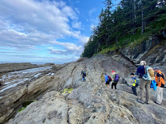
| Nootka Fossil Field Trip. Photo: John Fam |
The rugged west coast of Vancouver Island offers spectacular views of a wild British Columbia. Here the seas heave along the shores slowly eroding the magnificent deposits that often contain fossils.
Just off the shores of Vancouver Island, east of Gold River and south of Tahsis is the picturesque and remote Nootka Island.
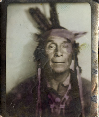
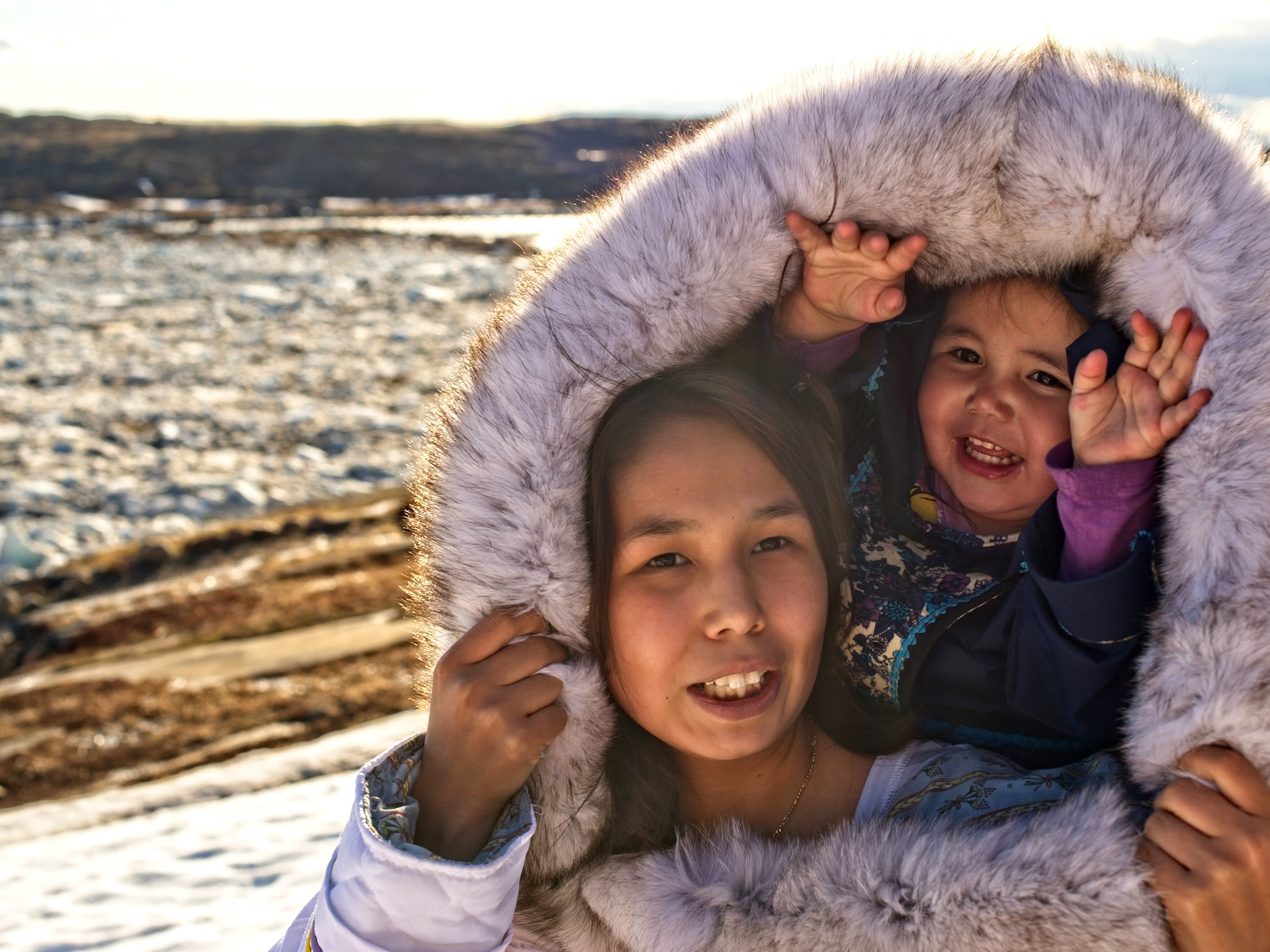
This is the land of the proud and thriving Nuu-chah-nulth First Nations who have lived here always.
Always is a long time, but we know from oral history and archaeological evidence that the Mowachaht and Muchalaht peoples lived here, along with many others, for many thousands of years — a time span much like always.
While we know this area as Nootka Sound and the land we explore for fossils as Nootka Island, these names stem from a wee misunderstanding.
Just four years after the 1774 visit by Spanish explorer Juan Pérez — and only a year before the Spanish established a military and fur trading post on the site of Yuquot — the Nuu-chah-nulth met the Englishman, James Cook.
Captain Cook sailed to the village of Yuquot just west of Vancouver Island to a very warm welcome. He and his crew stayed on for a month of storytelling, trading and ship repairs. Friendly, but not familiar with the local language, he misunderstood the name for both the people and land to be Nootka. In actual fact, Nootka means, go around, go around.
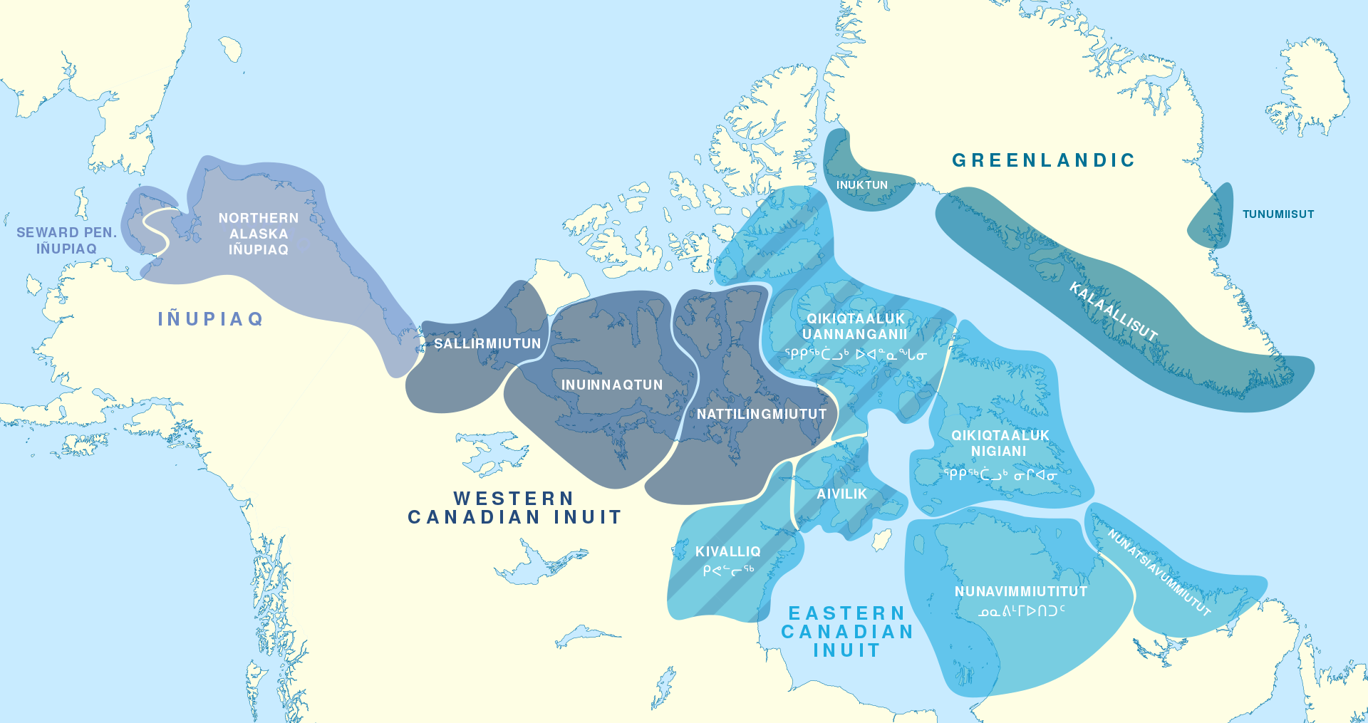
Two hundred years later, in 1978, the Nuu-chah-nulth chose the collective term Nuu-chah-nulth —
nuučaan̓uł, meaning
all along the mountains and sea or
along the outside (of Vancouver Island)
— to describe themselves.
It is a term now used to describe several First Nations people living along western Vancouver Island, British Columbia.
It is similar in a way to the use of the United Kingdom to refer to the lands of England, Scotland and Wales — though using United Kingdom-ers would be odd. Bless the Nuu-chah-nulth for their grace in choosing this collective name.
An older term for this group of peoples was Aht, which means people in their language and is a component in all the names of their subgroups, and of some locations — Yuquot, Mowachaht, Kyuquot, Opitsaht. While collectively, they are the Nuu-chah-nulth, be interested in their more regional name should you meet them.
But why does it matter? If you have ever mistakenly referred to someone from New Zealand as an Aussie or someone from Scotland as English, you have likely been schooled by an immediate — sometimes forceful, sometimes gracious — correction of your ways. The best answer to why it matters is because it matters.
Each of the subgroups of the Nuu-chah-nulth viewed their lands and seasonal migration within them (though not outside of them) from a viewpoint of inside and outside. Kla'a or outside is the term for their coastal environment and hilstis for their inside or inland environment.
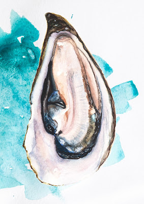
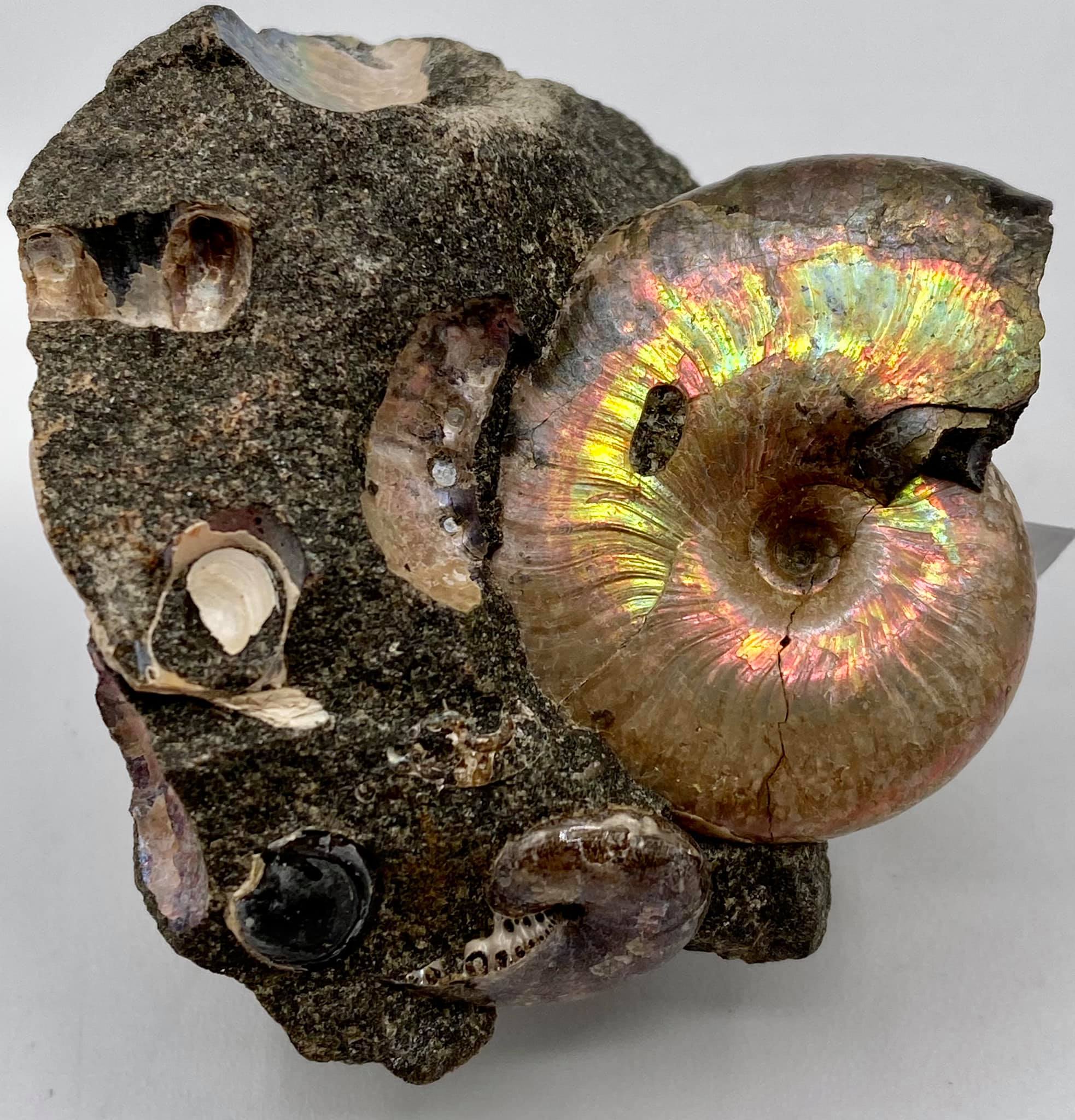
It is to their kla'a that I was most keen to explore. Here, the lovely Late Eocene and Early Miocene exposures offer up fossil crab, mostly the species Raninid, along with fossil gastropods, bivalves, pine cones and spectacularly — a singular seed pod. These wonderfully preserved specimens are found in concretion along the foreshore where time and tide erode them out each year.
Five years after Spanish explorer Juan Pérez's first visit, the Spanish built and maintained a military post at Yuquot where they tore down the local houses to build their own structures and set up what would become a significant fur trade port for the Northwest Coast — with the local Chief Maquinna's blessing and his warriors acting as middlemen to other First Nations.
Following reports of Cook's exploration British traders began to use the harbour of Nootka (Friendly Cove) as a base for a promising trade with China in sea-otter pelts but became embroiled with the Spanish who claimed (albeit erroneously) sovereignty over the Pacific Ocean.
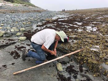 |
| Dan Bowen searching an outcrop. Photo: John Fam |
The ensuing Nootka Incident of 1790 nearly led to war between Britain and Spain (over lands neither could actually claim) but talk of war settled and the dispute was settled diplomatically.
George Vancouver on his subsequent exploration in 1792 circumnavigated the island and charted much of the coastline. His meeting with the Spanish captain Bodega y Quadra at Nootka was friendly but did not accomplish the expected formal ceding of land by the Spanish to the British.
It resulted however in his vain naming the island "Vancouver and Quadra." The Spanish captain's name was later dropped and given to the island on the east side of Discovery Strait. Again, another vain and unearned title that persists to this day.
Early settlement of the island was carried out mainly under the sponsorship of the Hudson's Bay Company whose lease from the Crown amounted to 7 shillings per year — that's roughly equal to £100.00 or $174 CDN today. Victoria, the capital of British Columbia, was founded in 1843 as Fort Victoria on the southern end of Vancouver Island by the Hudson's Bay Company's Chief Factor, Sir James Douglas.
With Douglas's help, the Hudson's Bay Company established Fort Rupert on the north end of Vancouver Island in 1849. Both became centres of fur trade and trade between First Nations and solidified the Hudson's Bay Company's trading monopoly in the Pacific Northwest.
The settlement of Fort Victoria on the southern tip of Vancouver Island — handily south of the 49th parallel — greatly aided British negotiators to retain all of the islands when a line was finally set to mark the northern boundary of the United States with the signing of the Oregon Boundary Treaty of 1846. Vancouver Island became a separate British colony in 1858. British Columbia, exclusive of the island, was made a colony in 1858 and in 1866 the two colonies were joined into one — becoming a province of Canada in 1871 with Victoria as the capital.
Dan Bowen, Chair of the Vancouver Island Palaeontological Society (VIPS) did a truly splendid talk on the Fossils of Nootka Sound. With his permission, I have uploaded the talk to the ARCHEA YouTube Channel for all to enjoy. Do take a boo, he is a great presenter. Dan also graciously provided the photos you see here. The last of the photos you see here is from the August 2021 Nootka Fossil Field Trip. Photo: John Fam, Vice-Chair, Vancouver Paleontological Society (VanPS).
Know Before You Go — Nootka Trail
The Nootka Trail passes through the traditional lands of the Mowachaht/Muchalat First Nations who have lived here since always. They share this area with humpback and Gray whales, orcas, seals, sea lions, black bears, wolves, cougars, eagles, ravens, sea birds, river otters, insects and the many colourful intertidal creatures that you'll want to photograph.
This is a remote West Coast wilderness experience. Getting to Nootka Island requires some planning as you'll need to take a seaplane or water taxi to reach the trailhead. The trail takes 4-8 days to cover the 37 km year-round hike. The peak season is July to September. Permits are not required for the hike.
Access via: Air Nootka floatplane, water taxi, or MV Uchuck III
- Dan Bowen, VIPS on the Fossils of Nootka: https://youtu.be/rsewBFztxSY
- https://www.thecanadianencyclopedia.ca/en/article/sir-james-douglas
- file:///C:/Users/tosca/Downloads/186162-Article%20Text-199217-1-10-20151106.pdf
- Nootka Trip Planning: https://mbguiding.ca/nootka-trail-nootka-island/#overview


.jpg)


.png)